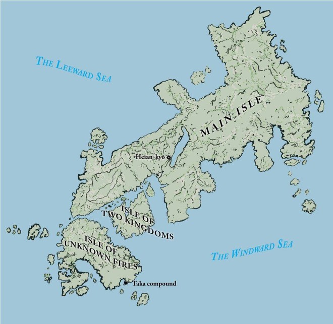
Readers of today have asked for a map of Yamabuki’s world. However, a 21st century map based on satellite positioning would show a universe totally at odds with what Yamabuki would likely have known.
People in Yamabuki’s era lived on a flat Earth suspended in space. The sun rose and set over the land. The oceans flowed over the edge of the horizon. Comets streaked through the skies. Some stars, wanderers–what today we call planets–moved around.
Many of the land masses we see from orbit would have been completely unknown to her and the shape of a world that’s a sphere would have been fantastical. Why don’t the people on the bottom of the fanciful globe simply fall off?
Yamabuki’s world of 1172 was largely uncharted and people would hold their breath for hundreds of years until what today we know as cartography came into existence.
Maps of the time were more like treasure maps than Google Maps. The Americas were not yet discovered, though there were rumors of it in Asia for the Chinese claimed to have visited a massive continent across the far Pacific (what Yamabuki called the Windward Sea) in the seventh century. Some even say the Chinese sailed to what today is called California.
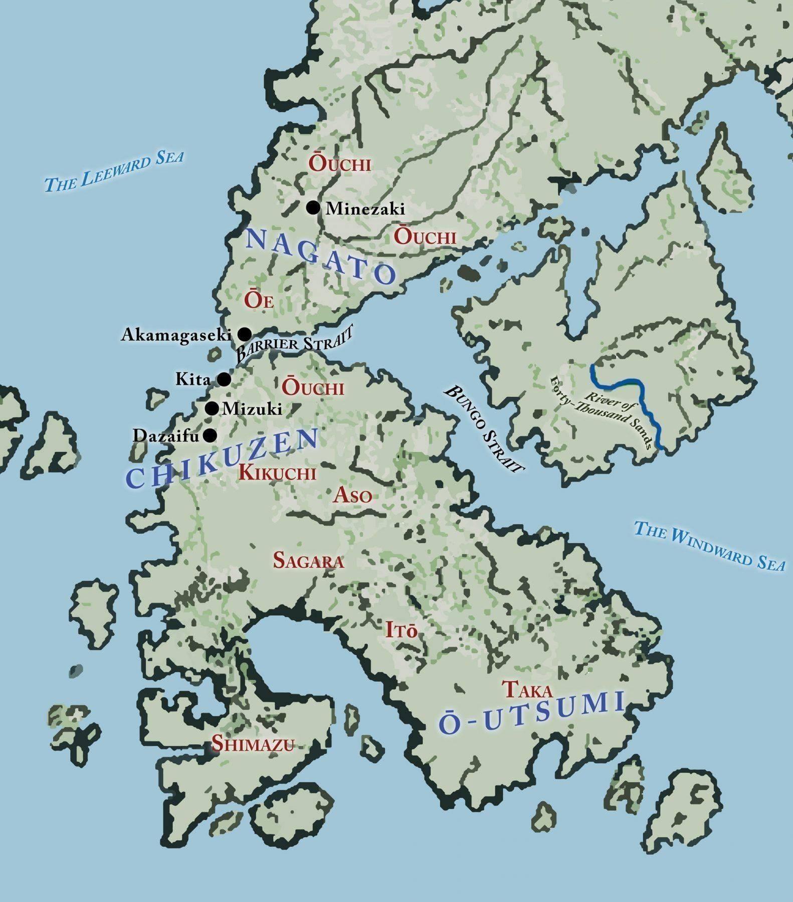
Yamabuki’s world, and the action taking place in the first four of the seven part Sword of the Taka Samurai is on the south western isle, The Isle of Unknown Fires which today is called Kyushu and across the Barrier Strait on the Main Isle, also known as Honshu.

The Barrier Strait today is called either the Kanmon Strait or the Strait of Shimonoseki. Nagato Prefecture, across the Strait from from the Isle of Unknown Fires, today is known as Yamaguchi prefecture. The modern names would have held no specific meaning for the young warrior as she goes on her journey.
The prefecture names are in large blue italics. Clan names in red. Population centers are in black. Bodies of water, channels, and rivers are also in italics.
In part one, _Cold Blood,_Yamabuki on her journey from O-Utsumi to Kita in Chikuzen prefecture would have followed the road through the lands of the Ito, Sagara, and Kikuchi, traveling through Dazaifu, Mizuki, and finally to Kita. She crosses the Barrier Strait and passes through Akamagaseki in Nagato.
In part two, Cold Rain, she arrives in Minezaki, where the North Road is intersected by the East-West Road, which is also known as The Smugglers’ Highway.
To intercept Yamabuki, Saburo would have come from the headwaters of The River of Forty Thousand Sands on the Isle of Two Kingdoms, crossing the Bungo Strait at the narrowest point, and hugged the coastline, traveling through the lands of the Ouchi before arriving in Kita.
The map is inspired. It is not what we would see from a satellite. It is not to scale, but it attempts to reflect a worldview of a people who are growing, expanding, and developing in an age that is very different from our own or even the one of the Warring States period, 300 to 400 years later.
More maps will be added as Yamabuki makes her way to the capital of Heian-kyo and beyond.
